UN
4 Church Hill Road
£ 430,000
Description
We don't have a Description for this property.
- Bedrooms
- 3
- Bathrooms
- 0
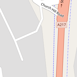

Leaflet © OpenStreetMap contributors
The heatmap indicates the level of crime in the area. The color of the heatmap indicates the crime severity and recency.
Metrics Year-on-Year
- Average area value
- 906,511.00 £Decreased by 10.54 %
- Average area rental value
- 2,414.00 £/moIncreased by 3.03 %
- Est rental Yield
- 3.20 %Increased by 15.52 %
- Crime Rate
- 2.00 %Unchanged by 0.00 %
from 1,013,333.00 £
from 2,343.00 £/mo
from 2.77 %
from 2.00 %
Nearby Schools
| Name | Type | Ofsted | Distance |
|---|---|---|---|
| Cheam High School | Academy Converter | Outstanding | 0.29 KM |
| Cheam Fields Primary Academy | Academy Converter | Good | 0.44 KM |
| St Dunstan'S Cheam Cofe Primary School | Voluntary Aided School | Good | 1.04 KM |
| Cheam Park Farm Primary Academy | Academy Converter | Outstanding | 1.07 KM |
| Brookways School | Other Independent Special School | Good | 1.38 KM |
Images
Nearby Streets
| Name | Average Price | Average Sqft | Distance |
|---|---|---|---|
| Church Farm Road | £ 0 | 0 | 0.00 KM |
| Stafford Close | £ 900,000 | 0 | 0.00 KM |
| Cheam Park Way | £ 0 | 0 | 0.00 KM |
| Westfield Close | £ 0 | 0 | 0.00 KM |
| Osprey Close | £ 0 | 0 | 0.00 KM |
Nearby Transport
| Name | NLC | TLC | Distance |
|---|---|---|---|
| Cheam | 5352 | CHE | 1.09 KM |
| West Sutton | 5293 | WSU | 1.16 KM |
| Sutton Common | 5436 | SUC | 2.39 KM |
| Sutton | 5385 | SUO | 2.77 KM |
| Belmont | 5350 | BLM | 3.01 KM |
Nearby Listings
| Address | Price | Type | Score | Distance |
|---|---|---|---|---|
| Church Hill Road, Cheam, Sutton, SM3 | £ 600,000 | BUY | 6 / 10 | 0.00 KM |
| Church Hill Road, Cheam, Sutton, SM3 | £ 600,000 | BUY | 8 / 10 | 0.01 KM |
| Church Hill Road, North Cheam | £ 550,000 | BUY | Unknown | 0.13 KM |
| Fieldsend Road, Cheam, Sutton | £ 675,000 | BUY | 7 / 10 | 0.13 KM |
| Matlock Gardens, Cheam, Sutton, Surrey, SM3 | £ 540,000 | BUY | 6 / 10 | 0.15 KM |
Nearby Properties
| Address | Price | Distance |
|---|---|---|
| 6 Church Hill Road | £ 495,000 | 0.00 KM |
| 9 Church Hill Road | £ 299,000 | 0.00 KM |
| 2b Church Hill Road | £ 352,000 | 0.00 KM |
| 43 Church Hill Road | £ 267,000 | 0.00 KM |
| 35 Church Hill Road | £ 426,000 | 0.00 KM |